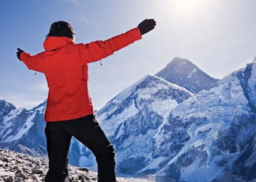
The Everest Base Camp (5,634 meters) is at the foot of the highest mountain in the world. One of the most fantastic trekking places in Nepal is Everest Base Camp trekking. The trek also allows one to stand at the foot of Mount Everest, which is 8,8848.86 meters.
The trek provides an opportunity to walk through various breathtaking landscapes while passing through picturesque Sherpa villages and observing views of the snow-capped mountains. Similarly, trekkers also immerse themselves in the Himalayan people's culture, customs, and hospitality.
While walking the Everest trekking route, trekkers traverse through lush vegetation, crossing numerous suspension bridges, and seeing various mountains like Everest, Lhotse, Nuptse, Pumori, Ama Dablam, Cho Oyu, Thamserku, and many others. So, trekking provides an opportunity to blend in with the Sherpa culture, test physical and mental ability, and push beyond the ordinary.
The Everest base camp trek map gives an overview of the most critical points, distances, and levels for traveling. It also specifies the exact route to get to the Everest Base Camp.
Besides a standard route from Lukla to Everest Base Camp, this map also provides alternative routes to other popular destinations around the Everest region. Likewise, the Everest Base Camp map details all created itineraries in the Everest region, including the Everest Base Camp 14-day trek.
Trekking Route Explanation
The 14-Day Everest Base Camp Trekking Map initiates with a domestic flight from Kathmandu (1,350 m) to Lukla. Lukla (2,860 m) is the only entry point to Everest, so it is also known as the gateway to Everest due to the presence of Tenzing Hillary Airport. To reach Lukla, trekkers must book a flight from Kathmandu via airplane or helicopter.
Upon reaching Lukla, official trekking begins to Phakding (2,610 m), the first village after Lukla. After Phakding, the next destination on the map is the vibrant village of Namche. Namche (3,440 m) is the most vibrant village in the Khumbu region and the first acclimatization point in the Everest Base Camp trekking route. Trekkers spend an extra day hiking towards higher altitudes and come down to adjust their bodies to lower oxygen levels.
After two nights in Namche, trekkers make their way to Tengboche. Tengboche (3,850 m) is also the home to the oldest monastery in the Everest region, known as the Tengboche monastery. The Tengboche monastery holds a prestigious position for the Khumbu people and is regarded as the spiritual heart of the area. The monastery is a spiritual and cultural site for the people who follow Tibetan Buddhism. Likewise, the monastery is more like a house of worship besides being an essential part of the artistic and religious life of the local Sherpa community.
After Tengboche, the next destination on the route is Dingboche. Dingboche (4,350 m) is a charming Sherpa village that offers stunning views of the mountains, including Ama Dablam (6,812 m), Lhotse (8,516 m), and Island Peak (6,165 m). Dingboche's beauty, culture, and hospitality make it one of the renowned resting points in the Everest trekking route. Similarly, Dingboche is another acclimatization stop during the Everest 14-day trek. Trekkers can hike up to Nangkartshang Peak at 5,083 meters and adapt to the lower oxygen level.
Then, from Dingboche, the route takes to Lobuche, another settlement near Mount Everest in Khumbu. Lobuche (4,946 m) is also a popular stop among trekkers, where they can complete the EBC trail or climb Kalapatthar for the rarest view of the Everest summit. Lobuche is named after several peaks that are visible from the area, such as Lobuche Far East, Lobuche East (6,119 m), Lobuche West (6,145 m), and Labuche Kang (located in Tibet).
From Lobuche, trekkers head to Gorak Shep (5,140 m), the last location before heading to the Everest Base Camp, and it is the previous accommodation stop before reaching the ultimate destination of Everest Base Camp. In 1852, Gorak Shep was originally the base camp of Everest, which the Swiss mountain climbers used; however, now it has been moved below Khumbu Icefall.
The next destination after Gorakshep is the iconic Everest Base Camp. It is located at 5634 meters and lies at the foot of the highest mountain in the world. However, only the summit of Everest is visible from the base camp, as Mount Nuptse, which lies ahead of Everest, blocks the view.
Trekkers continue the return journey after spending quality time on Everest and feeling full of achievement and celebration. According to the Everest Base Camp 14 Days Map, the route takes trekkers towards Kalapatthar for the grand view of Everest, and then trekkers head down to Pheriche.
Pheriche (4,371 meters) is another stop for trekkers and climbers. The dazzling village of Pheriche has a rudimentary hospital managed by the Himalayan Rescue Association. After an overnight stop in Pheriche, the next destination on the return journey is Namche Bazaar (3,440 m). Then, from Namche, trekkers head to Lukla for a flight to Kathmandu, marking the end of the Everest Base Camp 14-day trek with Trekking Planner Nepal.
Short Itinerary
Day 1: Upon your arrival in Kathmandu, our airport representative will welcome you and transfer you to your desired hotel, which is about 20-25 minutes' drive from the airport. This is an arrival day and day for preparation for the trek.
Day 2: Take a 35-minute morning flight from Kathmandu to Lukla (2,860m/9,383ft), followed by a 4-hour trek to Phakding (2,610m/8,560ft), covering a distance of 7.5 km/4.6 miles with an elevation gain of 230m/755ft.
Day 3: Trek to Namche Bazaar (3,440m/11,287ft), a 5-6 hour walk covering 12 km/7.45 miles with an elevation gain of 830m/2,723ft.
Day 4: Rest day at Namche Bazaar for acclimatization. Take a short hike to the Everest View Hotel at 3,880m/12,730ft, gaining 440m/1,444ft in elevation.
Day 5: Trek to Tengboche (3,850m/12,632ft), a 4-5 hour walk covering 10 km/6.21 miles, with an elevation gain of 420m/1,378ft.
Day 6: Trek to Dingboche (4,350m/14,272ft), a 4-5 hour walk covering 12 km/7.45 miles, with an elevation gain of 550m/1,805ft.
Day 7: Rest day at Dingboche for acclimatization. Take a hike to Nangkartshang Peak at 5,083m/16,677ft, gaining 673m/2,208ft in elevation.
Day 8: Trek to Lobuche (4,910m/16,109ft), a 4-5 hour walk covering 12 km/7.45 miles, with an elevation gain of 500m/1,640ft.
Day 9: Trek to Gorak Shep (5,180m/16,995ft), a 3-4 hour walk, followed by a 2-3 hour trek to Everest Base Camp (5,364m/17,598ft). The total trek covers 15 km/9.32 miles, with an elevation gain of 475m/1,489ft.
Day 10: Hike to Kala Patthar (5,545m/18,192ft) for panoramic views of Mount Everest, and then trek to Pheriche (4,371m/14,340ft) in 5 hours. The trek covers 13 km/8.07 miles with an elevation gain of 415m + 810m/1,362ft + 2,655ft.
Day 11: Trek from Pheriche to Namche Bazaar (3,440m/11,286ft), a 6-hour walk covering 14 km/8.69 miles, with an elevation gain of 800m/2,625ft.
Day 12: Trek from Namche Bazaar to Lukla (2,828m/9,279ft), a 6-hour walk covering 21 km/13.05 miles, with an elevation gain of 612m/2,008ft.
Day 13: Take a morning flight from Lukla back to Kathmandu.
Day 14: Transfer to the airport for your return flight home.

Invitation
So join hands with Trekking Planner Nepal for a fantastic adventure of a lifetime. Let us help you motivate you to go to the feet of the highest mountain on earth. Genuinely magnificent views, rich green vegetation, traditional settlement, and sherpa hospitality await you.
Purchase our 14-day package Everest Base Camp trek, tailor-made to your very needs. Call us now through Email, WhatsApp, or any other social media channel and reserve your spot for the trek. You can reach out for more details about the trek, preparation tips, and what to expect on this life-changing adventure.


